

Spatial intelligence platform · NSW
Planning intelligence. Mapped.
Search any NSW address, see the true lot boundary, run complying development and subdivision checks, track nearby DAs and share a live site link with your client — in one workspace.
What's new
Know every site. Before you quote.
Site investigation tools built straight into the map — no more jumping between portals.
CDC pre-check
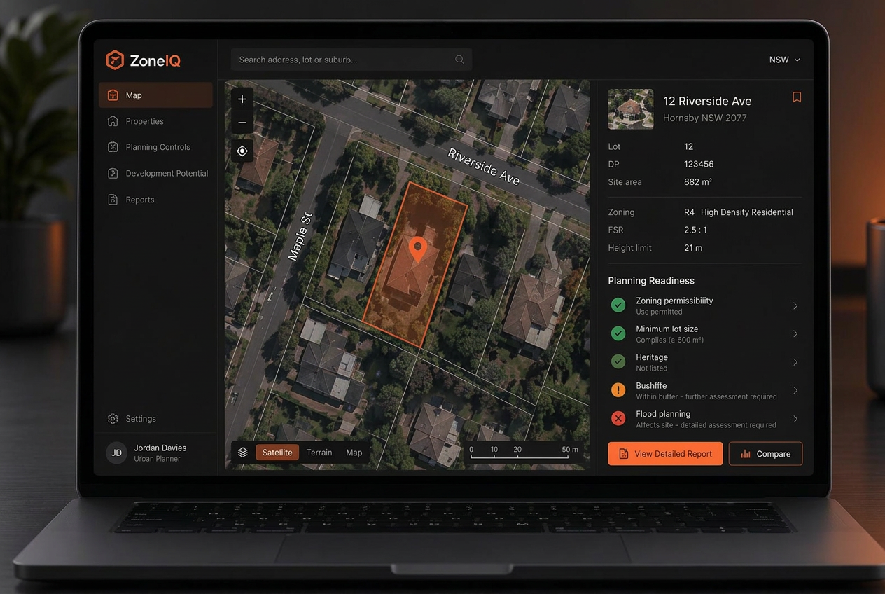
Screens the site against the NSW Codes SEPP with green, orange and red results for zone, lot size, heritage, flood, bushfire and more.
Subdivision sandbox
Side-by-side and battle-axe layouts from the real street frontage, with council access-handle rules and LEP/DCP compliance flags.
Elevation profile
Draw a line across the site to get a cross-section from NSW contours: fall, average and steepest grade.
DA activity & alerts
See development applications on the map and watch saved properties for new DAs nearby, checked every hour.
Client share links
Send a branded, read-only interactive site map to clients. Links can expire or be revoked any time.
Report-ready figures
Export 300 dpi map figures with north arrow, scale bar and legend, plus branded due diligence reports.
Instant address search
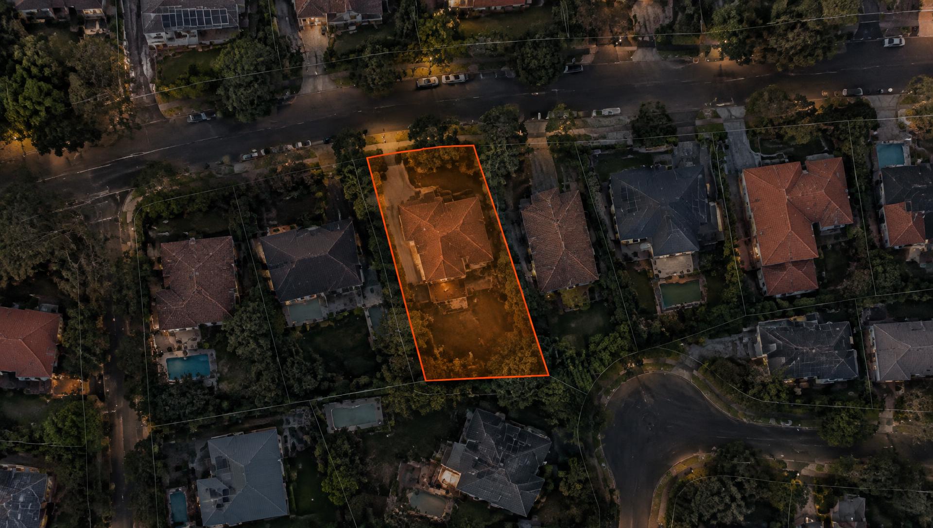
NSW address lookup that understands ranges and abbreviations, then draws the true cadastre boundary.
Lot boundaries & numbers
Lot lines and street numbers placed on the frontage, across the whole screen — on high-resolution aerial imagery.
Combine lots & refresh
Merge adjoining lots into one site, see when data was last fetched and refresh it with one click.
Site tools
Analyse a site in seconds
Open any property in the map and the Tools tab runs the first-pass checks you'd otherwise do by hand.
And the full workspace behind it
From cadastre lookup to council-ready reports, ZoneIQ replaces the patchwork of tools you use today.
Instant property intelligence
Paste an address and ZoneIQ resolves the cadastre polygon, lot/DP, site area, latitude/longitude, and address in one step.
Rich planning-layer enrichment
Automatically query zoning, FSR, height, heritage, acid-sulfate soils, flood, bushfire, coastal hazards, and more from NSW data sources.
Council-ready reports
Export branded PDF or Word reports with site particulars, land-use tables, map extracts, and all intersecting planning layers.
Project workflow
Track projects from enquiry through fee proposal, RFI, lodgement, and completion with a structured status pipeline and notes timeline.
Clients, consultants & councils
Link multiple clients, specialist consultants, and council contacts to each project and property so nothing lives in a silo.
Role-based access control
Organisation-level invites, position-based permissions, and activity logs keep every workspace secure and auditable.

Planning
for people,
places and
progress.
A clear workflow from site to submission
Capture the property, enrich it with data, run the project, and export the report.
Create a property
Use address autocomplete to set the site. ZoneIQ fetches the cadastre boundary and calculates site area automatically.
Enrich the record
Run a planning enrichment to pull zoning, land-use controls, environmental constraints, and infrastructure layers.
Attach to a project
Create a project, link the property, assign clients, consultants, and the council, then track progress through every stage.
Export the report
Generate a professional PDF or Word document with maps, layers, and land-use tables to support council submissions or client advice.
Built for property professionals
Whether you are a sole planner or a growing consultancy, ZoneIQ keeps your work organised and shareable.
Town planners
“Reduce the time spent jumping between council portals, PDF maps, and spreadsheets. One property record holds all the data you need.”
Property developers
“Quickly assess site potential, identify constraints, and package due diligence reports for investors or council pre-lodgement meetings.”
Planning consultancies
“Keep the whole team aligned on project status, RFIs, lodgement dates, and consultant inputs with a shared workspace.”
Simple per-user pricing. Projects when you need them.
Pick a tier for your team, then add projects for $20 per user per month. Every plan starts with a 14-day free trial, and your card is only charged when the trial ends.
All prices are in AUD and exclude GST. 10% GST is added at checkout for Australian customers.
| Compare plans | Standard | Pro |
|---|---|---|
| Property records & cadastre lookup | ||
| NSW planning-layer enrichment | ||
| Council contact directory & zone land-use tables | ||
| Branded PDF / Word property reports | ||
| 30 reports per user per month | ||
| Unlimited property reports | ||
| Projects, tasks, time, quotes & invoices (add-on) |
Onboarding, security & billing questions
Everything teams usually ask before moving their property and project work into ZoneIQ.
Onboarding
Security
Billing
Still have questions?
Our team can walk you through onboarding, security reviews, and procurement.
Ready to speed up your property workflow?
Join the teams using ZoneIQ to automate property research, manage projects, and produce consistent planning reports.